
Coastal Construction Control Line: What Florida Requires
By Judian Duran, PE, StS-1, Founder and Principal Structural Engineer at Duran Structural. Licensed in Florida, North Carolina, Georgia and Alabama. Last updated August 2026.
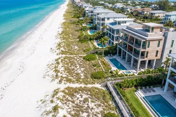
Florida tracks 432.5 miles of critically eroded beach, and since 1998 the Legislature has put more than $1.55 billion into restoring it (Florida DEP, 2026). That erosion is why the coastal construction control line exists. It’s a state-drawn line marking where the beach and dune system moves hard enough in a major storm to threaten anything built on it.
If you’re buying, designing or rebuilding on Florida’s Gulf or Atlantic beachfront, the CCCL is usually the biggest variable in your project. It changes who issues your permit, what your foundation looks like, how high your first floor sits, and whether the project is legal at all. Here’s how to check your parcel and what the line does to the structure.
Our coastal flood report places one lot against the control line and reads the county coastal zone it falls in.
Key Takeaways
- The CCCL defines the beach-dune area “subject to severe fluctuations based on a 100-year storm surge, storm waves, or other predictable weather conditions” (s. 161.053(1)(a), F.S., 2026). It’s a jurisdictional line, not a property line.
- Control lines exist for 25 sandy beach counties (Florida DEP, 2026). Elsewhere a 50-foot setback from mean high water applies under s. 161.052, F.S.
- The hard prohibition is the 30-year rule: DEP can’t permit a structure where erosion projections put it seaward of the seasonal high-water line within 30 years.
- Seaward of the line, habitable structures must be elevated on piles or columns and designed against an eroded “design grade” (Florida Building Code, Section 3109, 2023).
What Is the Coastal Construction Control Line?
The coastal construction control line is a jurisdictional boundary set by the Florida Department of Environmental Protection on a county basis. Florida Statutes direct DEP to establish the lines “so as to define that portion of the beach-dune system which is subject to severe fluctuations based on a 100-year storm surge, storm waves, or other predictable weather conditions” (s. 161.053(1)(a), F.S., 2026).
Read that closely, because most people misread it. The line isn’t a build-versus-no-build boundary and it isn’t a setback measured from your seawall. It’s the landward edge of the area where the state believes a 100-year storm can rearrange the ground. Land seaward of it can still be developed. It just moves into DEP’s jurisdiction, where siting and design are reviewed against Chapter 62B-33, F.A.C. before a local building department can act.
A second, wider zone gets confused with it constantly. The “coastal building zone” runs from the seasonal high-water line landward to a line 1,500 feet landward of the CCCL (s. 161.54(1), F.S., 2026). Plenty of properties sit inside that zone without being seaward of the control line.
Why Does Florida Have a CCCL?
Because Florida kept losing buildings. The Legislature’s finding is that protecting beaches and coastal barrier dunes from imprudent construction serves the public interest by preventing accelerated erosion, danger to adjacent properties and loss of public beach access (s. 161.053, F.S., 2026).
The engineering logic is simple. A dune is a sand reservoir. During a major storm that reservoir drains seaward, the ground drops several feet, and a foundation that was buried is suddenly exposed to breaking waves and scour. A building sited too far seaward also concentrates energy on its neighbors, the same failure chain we walk through in seawall failure warning signs. Enforcement has teeth: violations are a first-degree misdemeanor.
How Do You Find Out If Your Property Is Seaward of the CCCL?
DEP publishes the answer for free. Its LOCATE the CCCL page hosts Map Direct, an interactive GIS where you find your parcel and check whether the project falls seaward of the control line, shown as a solid red line. DEP also runs the COASTS imagery database and a geodata portal for the raw GIS layers. Do that check before you make an offer. A CCCL determination changes the buildable envelope, the foundation system and the schedule, so it changes what the land is worth to you.
One caution for Tampa Bay owners: not every waterfront lot is coastal in the statutory sense. The 50-foot setback in s. 161.052 applies to riparian locations fronting the Gulf or Atlantic and expressly excludes bays, inlets, rivers, bayous, creeks and passes. Much of the bay’s own frontage falls outside both, while Pinellas County’s Gulf beaches sit squarely inside the program.
| Your site | Governing line | Authority |
|---|---|---|
| Sandy Gulf or Atlantic beach in one of the 25 counties with a control line | Coastal construction control line | s. 161.053, F.S. |
| Sandy or pocket beach with no established CCCL (Big Bend, the Keys) | 50-foot setback from mean high water | s. 161.052, F.S. |
| Within 1,500 feet landward of the CCCL | Coastal building zone | s. 161.54(1), F.S. |
| Frontage on a bay, inlet, river, bayou, creek or pass | Generally outside both; local rules still apply | s. 161.052(1), F.S. |
What Permitting Does the CCCL Trigger?
A DEP authorization on top of your local building permit. Construction and excavation seaward of the control line require a DEP permit unless exempt, and there are several paths depending on scope: individual administrative permits, general permits under Chapter 62B-34, F.A.C., emergency permits and dune core permits (Florida DEP, 2026).
Some minor work is exempt. Rule 62B-33.004(2)(c), F.A.C. lists exemptions such as beach furniture and awnings, tie-downs to existing minor structures, mono-post umbrellas and light posts, and minor maintenance of bulkheads and seawalls. It’s a narrow category, and a slab, a pool or a pile cap generally isn’t in it.
The application itself is an engineering submittal, not a form. Rule 62B-33.008(1), F.A.C. requires a signed and sealed survey from field work conducted not more than six months before the application date, plus site plans, grading plans and cross-sections signed and sealed by a registered professional. Foundation plans are required for major habitable multifamily structures, and documents for rigid coastal structures such as seawalls must be signed and sealed by an engineer licensed in the State of Florida.
Plan for iteration. Applicants get 180 days to respond to a request for additional information under Rule 62B-33.008(5), F.A.C. DEP publishes no fixed approval timeline, so treat the review as a real schedule item, not a rubber stamp at the end of design.
The 30-Year Erosion Projection
This is the rule that stops projects, and it surprises almost everyone. DEP, or a local government with delegated permitting authority, may not issue a permit for a structure proposed for a location that, based on the department’s erosion projections, will be seaward of the seasonal high-water line within 30 years after the application date (s. 161.053(5)(b), F.S., 2026). The statute defines that line as the intersection of the rising shore with an elevation 150 percent of the local mean tidal range above local mean high water.
A limited exception in s. 161.053(5)(c) covers rebuilding single-family dwellings on platted parcels when conditions are met, including that the dwelling sits landward of the frontal dune structure. If you’re rebuilding after storm damage, read it before you commit to a footprint. Our post-storm structural evaluation work often starts here.
“The control line doesn’t tell you that you can’t build. It tells you the ground under your building might not be there after the storm, and it asks you to prove your structure doesn’t need it.”
How Does the CCCL Change Structural Design?
It changes the ground assumption, and everything follows from that. Under Florida Building Code Section 3109, which governs habitable structures entirely seaward of the control line or the 50-foot setback, you design against a “design grade,” the predicted eroded grade, rather than the grade you can stand on today.
That single substitution drives the rest. Pairing an eroded grade with a breaking wave crest is why coastal piles run so much longer than inland ones, and it pushes finished floors well above what an elevation certificate alone would suggest. All of it sits on top of the coastal exposure and high design wind speeds we cover in wind load requirements for Tampa Bay homes.
| Design item | Typical inland site | Entirely seaward of the CCCL | Code |
|---|---|---|---|
| Ground assumption | Existing grade | Design grade (predicted eroded grade) | FBC 3109.2 |
| Foundation | Shallow footings or slab on grade | Piles or columns, 8:1 minimum spacing-to-diameter ratio | FBC 3109.3.2 |
| Lowest floor | Per local flood requirements | Highest of ASCE 24 Ch. 4, local rule, or 100-year storm elevation | FBC 3109.3.3 |
| Flood loads | Often not governing | ASCE 7 Ch. 5, stillwater depth from design grade | FBC 3109.3.1 |
| Walls below flood elevation | Conventional framing | Breakaway walls per ASCE 24 Section 4.6 | FBC 3109.3.4 |
| Approvals | Local building department | Local building department plus DEP authorization | s. 161.053, F.S. |
Is this more expensive than an inland build? Yes, and the honest framing is that you’re buying a structure that survives losing its own dune. That’s why this work overlaps so heavily with house lifting and flood mitigation on existing beachfront homes.
Start With the Line, Not the Floor Plan
If your parcel is anywhere near the beach, the sequence that saves money is: locate the control line, answer the 30-year projection question, then design. Reversing that order is how drawings get thrown out.
Our coastal engineering team handles CCCL-driven design for new construction, renovations and additions, and residential and commercial beachfront property. For background reading, our resources page collects the coastal and post-storm guidance we give clients, alongside our firm profile and services.
Frequently Asked Questions
Does being seaward of the CCCL mean I can’t build?
No. The line defines the portion of the beach-dune system subject to severe fluctuation from a 100-year storm surge (s. 161.053(1)(a), F.S.), and DEP does issue permits for construction seaward of it. The real prohibition is the 30-year erosion projection in s. 161.053(5)(b), which bars permits for structures projected to sit seaward of the seasonal high-water line within 30 years.
How do I check whether my property is seaward of the line?
Use DEP’s Map Direct GIS through the LOCATE the CCCL page, where the control line appears as a solid red line over parcel data. DEP also publishes the COASTS imagery database and downloadable GIS layers. Confirm the result with the county CCCL permit manager before relying on it for a purchase decision.
Which Florida counties have a coastal construction control line?
Control lines are established for 25 sandy beach counties (Florida DEP, 2026). Big Bend counties and the Keys are handled differently: where no CCCL exists, s. 161.052, F.S. applies a 50-foot setback from mean high water to sandy pocket beaches on Gulf and Atlantic frontage.
Do I need a licensed engineer for a CCCL permit application?
For most real projects, yes. Rule 62B-33.008(1), F.A.C. requires site plans, grading plans and cross-sections signed and sealed by a registered professional, foundation plans and specifications for major habitable multifamily structures, and documents for rigid coastal structures signed and sealed by an engineer licensed in the State of Florida.
What happens to CCCL rules after a hurricane?
DEP runs an emergency permitting track covering work seaward of the control lines established for the 25 sandy beach counties, or seaward of the 50-foot setback from mean high water, with guidance published for property owners and local governments. Emergency authorization doesn’t waive the structural design requirements for permanent reconstruction. See our guidance on hurricane structural damage claims.
The Bottom Line
The coastal construction control line isn’t a ban and it isn’t a formality. It’s the state telling you, with 100-year storm data behind it, that the ground under a beachfront structure is temporary. Once you accept that, the requirements in Section 3109 stop looking arbitrary and start looking like the minimum cost of building where the shoreline moves.
Check the line first. If your project is seaward of it, or you aren’t sure, contact our team at (813) 536-8002 for a review of what the CCCL means for your parcel. Judian brings more than 100 projects across over a decade, and coastal work is a core line for us. Still deciding whether you need an engineer? Start with when you need a structural engineer in Tampa.
Always consult a licensed engineer for your specific project. Statutory and code requirements change, and site conditions govern.
Judian Duran, PE, StS-1 is the founder and principal structural engineer of Duran Structural, a boutique Tampa firm serving all of Florida. He’s a licensed Professional Engineer in Florida, North Carolina, Georgia and Alabama with over a decade across 100+ coastal, historic, healthcare and high-rise projects, and he previously spent eight years as a project engineer at Thornton Tomasetti. As a Structures Specialist (StS-1) on Florida Urban Search and Rescue Task Force 3, he leads Duran’s post-storm structural assessment work. He is Vice President of the ASCE West Coast Branch and president of the FSEA Bay Area chapter. He also sits on the ASCE 24 Flood-Resistant Design committee and is a contributing author to FEMA P-2345, the Building Designer’s Guide to Calculating Flood Loads Using ASCE 7-22 Supplement 2.
