
Flood Elevation Certificate: What It Is, Who Signs It
By Judian Duran, PE, StS-1, Founder and Principal Structural Engineer at Duran Structural. Last updated August 2026.
If you own or plan to build near the water in Tampa Bay, sooner or later somebody asks for a flood elevation certificate. The lender wants one. The insurance agent wants one. The county wants elevation documentation before it closes a permit. Almost nobody explains what the document is, or who’s allowed to sign it.
Here’s the short version. An Elevation Certificate is a FEMA form recording how high parts of a building sit relative to a measured flood elevation. It isn’t a structural inspection, and most of the time we’re not the right firm to produce it. Below: what’s on the form, who can legally complete it, how your flood zone drives what you build and what you pay to insure it, and where a structural engineer genuinely belongs.
Key Takeaways
- FEMA is blunt about authorship: the form “is to be completed by a land surveyor, engineer, or architect who is authorized by state law to certify elevation information” (FEMA Form FF-206-FY-22-152, 2023). In Florida that’s usually a licensed surveyor, not a structural engineer.
- The certificate is now “an optional tool” for insurance rating, but your community can still require one to issue a permit (FEMA, 2025).
- Florida’s 8th Edition (2023) Building Code requires as-built elevation documentation sealed by “a licensed professional surveyor and mapper or registered design professional” (Florida DEM, 2023).
- Engineers become mandatory in V Zones: NFIP rules require a registered professional engineer or architect to certify the design resists wind and water loads acting simultaneously (FEMA, 2020).
What is a flood elevation certificate?
It’s FEMA Form FF-206-FY-22-152, formerly 086-0-33 (FEMA, 2023). It records surveyed elevations of a building’s lowest floor, lowest adjacent grade, machinery and equipment, and in coastal zones the bottom of the lowest horizontal structural member. It documents a height. It says nothing about whether the structure is sound.
The form runs in lettered sections: Section A for the building and foundation type, Section B tying the property to a specific Flood Insurance Rate Map panel and flood zone, Section C for the surveyed elevations (labeled “survey required”), and Section D for the certification block with license number and seal. Photographs come with it: at least two and where possible four color photos, taken within 90 days of certification.
Who can complete an elevation certificate?
FEMA limits this to three professions, then adds a condition most people skip. The form “is to be completed by a land surveyor, engineer, or architect who is authorized by state law to certify elevation information” (FEMA, 2023). Authorization under state law is the operative phrase, and it’s why the practical answer in Florida is a surveyor.
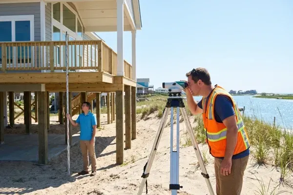
Measuring a lowest floor elevation against a vertical datum is surveying work. A licensed professional surveyor and mapper owns that scope, carries the instruments and benchmarks, and does it weekly. We’re a structural engineering firm. Call us about a certificate for a house in Zone AE and the honest answer is that a surveyor will do it faster and cheaper. We’d rather say that than bill you to learn it.
There are narrow exceptions. Floodplain officials authorized by ordinance may complete the form, and in Zones AO, AR/AO, and A without a published base flood elevation, an official or an owner’s representative may supply Section E compliance information, unless it supports a map change request. FEMA also publishes a fillable version for owners to self-report first floor height for insurance (FEMA, 2025). None of that helps at a permit desk in a mapped AE or VE zone.
How do you find your flood zone and base flood elevation?
Start at the FEMA Flood Map Service Center at msc.fema.gov, then confirm with your county. A Special Flood Hazard Area is the area inundated by the flood event having a 1 percent chance of being equaled or exceeded in any given year, also called the base flood or 100-year flood (FEMA, 2020). The base flood elevation is that event’s water surface elevation (FEMA, 2020). Two houses on one street can sit in different zones. That’s topography, not an error.
| Zone on the FIRM | What it means | BFE published? | Elevation reference |
|---|---|---|---|
| A | SFHA, detailed study not completed | No | Lowest floor |
| AE, A1-A30 | SFHA with a studied base flood elevation | Yes | Lowest floor |
| AO, AH | Shallow flooding, sheet flow or ponding | Depth or BFE | Lowest floor above grade |
| Coastal A Zone | Wave heights of 1.5 to 3 feet, or designated locally | Yes | Bottom of lowest horizontal member |
| VE, V1-V30 | Coastal high hazard area, high-velocity wave action | Yes | Bottom of lowest horizontal member |
| X (shaded) | Between the base flood and the 0.2 percent annual chance flood | No | Not applicable |
| X (unshaded) | Minimal hazard, outside the SFHA | No | Not applicable |
Zones per FEMA (2020); Coastal A Zone wave heights per 8th Edition Florida Building Code, Residential, R322.2.
How does your flood zone change what you can build?
It changes the governing standard, not just the height. The Florida Building Code requires design and construction in flood hazard areas, including coastal high hazard areas and Coastal A Zones, to follow Chapter 5 of ASCE 7 and ASCE 24 (Florida Division of Emergency Management, 2023). Those govern flood loads, foundation selection, and connection design, and they stack on top of the wind rules in our post on wind load requirements for Tampa Bay homes.
The documentation requirement is separate. Residential Section R322.1.10 states that “a licensed professional surveyor and mapper or registered design professional shall prepare and seal documentation of the elevations.” Commercial Section 1612.5 adds two items for V Zones and Coastal A Zones: the elevation of the bottom of the lowest horizontal structural member, and a statement in the construction documents that the structure resists flotation, collapse, and lateral movement from wind and flood loads acting simultaneously.
That’s the fork in the road. The elevation number is survey work. The statement that the structure resists those loads is engineering work, and it belongs in sealed construction documents.
Does an elevation certificate lower flood insurance costs?
It can, and it’s no longer required to buy a policy. FEMA describes Elevation Certificates as “an optional tool” for evaluating a building’s First Floor Height, and says that when owners supply one with more detailed information, “the flood insurance rating engine may return a lower annual premium” (FEMA, 2025). FEMA estimates first floor height on its own. A survey either confirms that estimate or corrects it.
The purchase requirement hasn’t gone away. Under the Flood Disaster Protection Act of 1973, owners buying, building, or improving property in a Special Flood Hazard Area in a participating community must carry flood insurance as a condition of federal financial assistance, including a federally backed mortgage (FEMA, 2020).
“The certificate answers one question: how high. It never answers whether the foundation under that floor can take a storm surge. Owners get burned when they treat the second question as answered because the first one was.”
- Judian Duran, PE
Not sure which one you need? Call (813) 536-8002 and we’ll tell you whether it’s a survey scope or an engineering scope. Our coastal structural engineering services cover the second.
What happens if your renovation triggers the 50 percent rule?
The whole building has to come into compliance. FEMA defines substantial improvement as any reconstruction, rehabilitation, addition, or other improvement whose cost equals or exceeds 50 percent of the structure’s market value before construction starts, and the term includes structures that have suffered substantial damage regardless of the repair performed (FEMA, 2023).
Hillsborough County applies that threshold to both improvement and damage, and reviews a signed owner and contractor worksheet with the permit application. A useful budgeting detail: the county’s cost breakdown excludes land survey costs and the cost of preparing plans and specifications (Hillsborough County). Hiring a surveyor and an engineer doesn’t push you toward the threshold.
Cross the line and elevation stops being paperwork and becomes a project. That’s the road to lifting a home before a flood lift. After a storm, the determination usually follows a post-storm structural evaluation, then feeds into a hurricane damage insurance claim.
Where does a structural engineer fit, and where does a surveyor?
A surveyor establishes elevations. An engineer designs and evaluates the structure sitting at those elevations. Both are licensed professionals with sealed deliverables, and mixing them up costs owners money, the same way people confuse a structural engineer with a home inspector.
FEMA draws the line clearly in coastal high hazard areas. Buildings in V Zones must be anchored to resist wind and water loads acting simultaneously, and “a registered professional engineer or architect must certify that the design and planned methods of construction meet NFIP requirements.” Breakaway walls enclosing space below the building that exceed a design safe loading resistance of 20 pounds per square foot also require certification by that engineer or architect (FEMA, 2020).
So: call a surveyor for the Elevation Certificate, a lowest floor elevation for a permit, or a Letter of Map Change submittal. Call us for V Zone and Coastal A Zone foundation design, pile and column systems, breakaway wall certification, ASCE 24 statements in construction documents, or a structural assessment and peer review of someone else’s flood design. Shoreline work, including the seawall warning signs common on these properties, sits on our side too.
Planning new coastal construction, an addition or renovation that may trip the 50 percent rule, or a residential elevation project? Bring the engineer in early. Foundation decisions cost far less before the permit than after.
Frequently Asked Questions
Can a structural engineer sign my elevation certificate?
Legally, sometimes. FEMA permits a land surveyor, engineer, or architect “authorized by state law to certify elevation information” to complete the form (FEMA, 2023). In practice, elevation measurement is surveying scope in Florida, so a licensed surveyor and mapper is the right call for a routine certificate.
Do I still need an elevation certificate for flood insurance?
Not to buy a policy. FEMA now calls the certificate “an optional tool” and estimates first floor height itself, though submitting one “may return a lower annual premium” where it shows your building sits higher than modeled (FEMA, 2025). Your community may still require one for permitting.
How do I find my base flood elevation in Tampa?
Look up the property at the FEMA Flood Map Service Center, then verify with the county. The base flood elevation is the water surface elevation of the flood with a 1 percent chance of being equaled or exceeded in any year, and it’s published for zones AE, AH, and VE (FEMA, 2020).
What’s the difference between Zone AE and Zone VE?
VE is a coastal high hazard area subject to high-velocity wave action. Buildings there must sit above the base flood elevation and be protected from wave impact, hurricane-force winds, and erosion, and the design requires certification by a registered professional engineer or architect (FEMA, 2020). Zone AE has no such requirement.
Does an old elevation certificate still count?
It depends what changed. The certifier’s photographs must be taken within 90 days of certification, and the form is tied to a specific Flood Insurance Rate Map panel and datum (FEMA, 2023). If the map has been revised or the building altered, the old certificate no longer describes current conditions.
Get the right professional on it the first time
Most Tampa Bay owners who call us about a flood elevation certificate need a surveyor, and we say so on the phone. What we’re built for is the engineering underneath the number: coastal foundations, ASCE 24 compliance, V Zone design certification, and clear-eyed evaluations of what a structure can take. Duran Structural is a boutique Tampa firm with over a decade of principal experience across 100+ projects, licensed in Florida, North Carolina, Georgia, and Alabama.
If your project sits in a mapped flood zone, the cheapest hour you’ll spend is the one before design starts. Browse our resources, review our coastal engineering work, then contact our team or call (813) 536-8002. If a storm just came through, start with a post-storm structural assessment. Confirm your community’s requirements, which may exceed the minimums above, with a licensed engineer.
Judian Duran, PE, StS-1 is the founder and principal structural engineer of Duran Structural, a boutique Tampa firm serving Florida and the Southeast. He’s a licensed Professional Engineer in Florida, North Carolina, Georgia, and Alabama with over a decade of experience across 100+ projects, including eight years as a project engineer at Thornton Tomasetti. As a Structures Specialist (StS-1) on Florida Urban Search & Rescue Task Force 3, he leads Duran’s post-storm evaluation work. Not sure when you need a structural engineer in Tampa? Start there. He also sits on the ASCE 24 Flood-Resistant Design committee and is a contributing author to FEMA P-2345, the Building Designer’s Guide to Calculating Flood Loads Using ASCE 7-22 Supplement 2.
